Monday, April 15, 2013

LAD202 - BIM for landscape architecture using Revit

Having tried some of Henning Lindgren Jensen's tutorials for using Revit in landscape architecture I realize this should be accessible on this blog and not only for those who are member of LAD202 on fronter (like I am). I like it, and I think i will like using Revit, so I'm publishing his (with Henning's blessing) lectures and exercises here so we all can find what we need to get started with Revit.

Here it is: LAD202 – 3D Computer Modelling for Landscape Architecture - spring 2013 – part#2 using Revit Architecture for Landscape:

Lecture 1 - Introduction to BIM / User interface Revit Architecture
Lecture 2 - From 2D to 5D / Start a BIM project in Revit

Lecture 3 - Revit Architecture_Basic design tools


  • Recording from lecture by Åge Langedrag (no sound)
    Type
    Size
    Link
    Flash (Original Size)
    260 MB
    iPad
    199 MB
    iPod and iPhone
    87.0 MB
Lecture 4 - From sketch to BIM model
Lecture 5 - Revit families

Wednesday, February 27, 2013

LAD202 - Civil 3D

LAD202 – 3D Computer Modelling for Landscape Architecture - spring 2013 – part#1 using AutoCAD Civil 3D. 
Following this course and having access to all the files that we use are easy as long as the course is running and the fronter-room is open. However, when the semester is over and you start over again next year, you have been kicked out of fronter and all the information from the course is gone! So did you save it all on your hard drive? Do you have all the template-files? Probably not, but no need to worry. Course material is now available to you for dowloading from a public folder on dropbox (no need to log in before you download or view them).

Lecture 01 - 3D in AutoCAD
Lecture 02 - C3D terrain models - surface
Lecture 03 - C3D terrain modeling
Lecture 04 - C3D terrain analysis

  • recording from lecture 04
  • Type
    Size
    Link
    Flash (Original Size)
    232 MB
    iPad
    153 MB
    iPod and iPhone
    67.4 MB


Lecture 05 - C3D FeatureLines Grading I
Lecture 06 - C3D FeatureLines Grading II
Lecture 07 - C3D Alingment. Profile
Lecture 08 - C3D Site engineering and design
Lecture 09 - C3D Discussion
  • recording from lecture 09
    Type
    Size
    Link
    Flash (Original Size)
    217 MB
    iPad
    149 MB
    iPod and iPhone
    69.9 MB

Friday, December 7, 2012

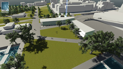
3D in Design 2012 course. Experience with Lumion3D


Students with intermediate digital modelling skills from ILP (Department of Landscape Architecture and Spatial Planning) joined the course with the objective to explore new potentials and complications associated with 3D modelling and visualizations in interaction with landscape, urban systems and dynamics, architecture and construction. The emphasis is put on investigation of the added values of using 3D in design. The course offers the possibilities to work with latest developments in 3D technology for collaboration and communication of design concepts represented by the launch of a new 3D visualization software package for designers “LUMION3D” developed by ACT-3D B.V. The Virtual Reality Lab at UMB provided an arena for testing and experimenting of new ways of knowledge-sharing, increasing collaboration, motivation and engaged learning.

Students were able to test new potentials through a number of study cases connected to the following topics: Outdoor lighting scenarios; urban planning; large scale landscape planning; landscape architecture; designing with plants. The topics were connected to the following courses offered both at ILP and IMT: 
. LAA320 - Outdoor Lighting.
. LAA340 - Sustainable Design and Management of blue/green environmental.
. LAA350 - Architecture, urban form and development.
. LAA 224 - Designing with plants
. TBA310 - Building Design III.

The following students joined the course for 2012: Arta Bilinska, Christina Sæter, Hedvig Godvik Olsen, Hege Tvete, Hege Tjoflåt Borsheim, Jesper Vesøen, Kathrine Jensen, Katrina Ottesen Stone, Knut Runar Bruflot, Kristiana Sakina Novika, Maria Annett Callanta Borgersen, Marianne Finserås Larsen, Ola Martinsen, Pål Dixon Sandberg.

Click on the image to see the photo album of students work

Monday, September 10, 2012

How to model 3D terrain in SketchUp


For many who are using SketchUp as main 3D modeling tool for landscape architectural design and landscape planning, 3D terrain modeling has been seen as a complicated subject. Which methods one should follow has been always a question. Daniel Tal, known from his book “SketchUp for Site Design” has published article on how to model a terrain in SketchUp. A good article outlines methods, techniques and plug-ins to follow in order to create a 3D terrain with SketchUp. Originally published in the October 2012 edition of Landscape Architecture Magazine. You could find the article from this link:Learning to model terrain in SketchUp ( by Daniel Tal, edited by Daniel Jost )

3D terrain from the article by Daniel Tal